Welcome
A collection of writings, research and reflections on the historical development of land and law related subjects.
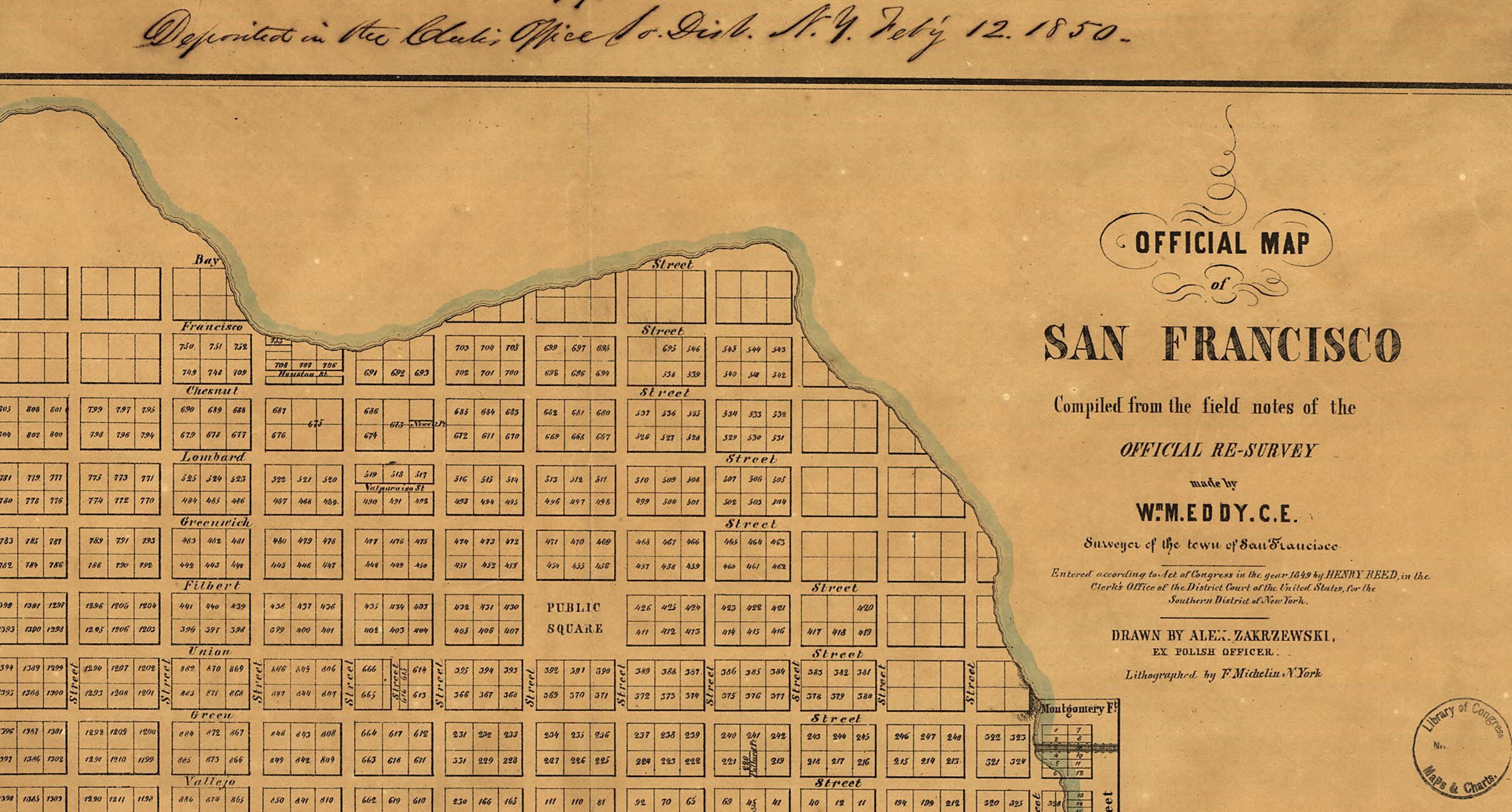
This 1851 “Eddy” map of San Francisco is the earliest known map by a City Surveyor. It was never officially adopted by the City although it was performed by an officer of the County in the conduct of his official duties. This map created the streets and blocks that still exist in San Francisco. The early years of the City were full of conflicts between claimants, speculators, squatters and government entities. It took decades to resolve these problems. Legal disputes reached the U.S. Supreme Court and required an Act of Congress to resolve. These issues percolate into present day property ambiguities throughout the City and County of San Francisco. Although the former pueblo is recognized, our legal system of land records contains little or no reference to native claims prior to colonization.
As in San Francisco, properties throughout California may contain hidden historical defects. Patience in understanding this history is essential. Once known, solutions may be simple if transparency and neighbor cooperation are sustained.
Wise words on lawyering:
“Discourage litigation. Persuade your neighbors to compromise whenever you can. Point out to them how the nominal winner is often a real loser—in fees, expenses, and waste of time. As a peacemaker the lawyer has a superior opportunity of being a good man (or woman). There will still be business enough.” -Abraham Lincoln, Notes for a Law Lecture, 1850


Articles and Resources
Explore a wide range of articles, expert insights, and resources…
-

Survey Monuments should be permanent
But do they rival the Cyrus Cylinder? In a remarkable find, the Cyrus Cylinder, a…
-

LEGAL DESCRIPTIONS: Why Old Legal Descriptions may be pitfalls for the unwary
Excerpted from an article originally published for Continuing Education of the Bar (CEB) in the…

-
Paul Mabry is a professional land surveyor, attorney, mediator and arbitrator. He enjoys helping others learn about the role land played (and plays) in culture and history.